
Recently, two articles about assessing the value of data caught our attention. If you need to justify investment in data management and data sharing, they’ll be a useful part of your toolkit.
Tool one – measuring value
The first tool comes from the Geospatial Commission.
The Geospatial Commission recently published guidance on measuring the value of geospatial data. This was part of its commitment to Mission One of the UK Geospatial Strategy.
Although focused on public sector data, the guidance is also valuable to any organisation that needs to value its data holdings.
Data is like a meal at a restaurant
We agree with the Geospatial Commission’s view that measuring the value of data is hard. In economic terms, it’s an “Experience Good”, in other words, it’s like a meal out at a restaurant – you can’t know its value until you’ve sampled it and paid the bill!
Fluctuating data values
The value of a dataset changes depending on its use. It can also fluctuate over time. A dataset may be of limited importance at the time of data collection, but future circumstances may boost its value. For example:
- In the event of another pandemic
- If there are legislative changes
- If there are technological changes
Furthermore, the true value of data only becomes clear when it is used or combined with other datasets. For example, the Scottish Heatmap combines data and metadata on housing, geology and energy supply into a powerful tool for visually assessing heat supply and demand, hopefully helping to reduce carbon emissions.
Data is a valuable asset
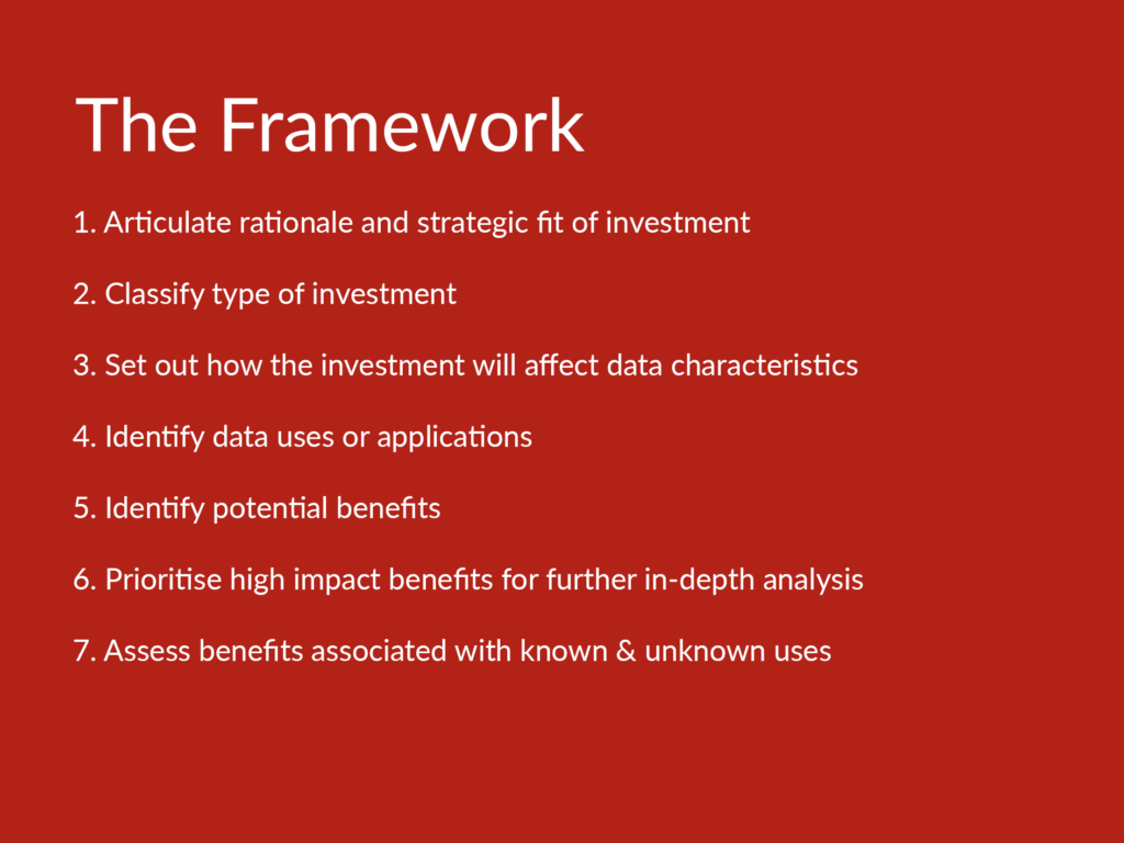
Even if you don’t go into all the details of the seven-step framework set out in the guidance, there are some important take-home points.
Jo Cook, our Lead Data Discoverability Specialist, comments,
“Data should be treated as a financial asset or investment. This means that the tools and resources required to manage and share data are investments in their own right. Choosing the right tools can shape your organisation’s ability to deliver against its objectives.”
The guidance highlights that the value of a dataset is explicitly dependent on its metadata (or data characteristics) and on a Q-FAIR approach.
Put simply, to “maximise the ROI” of your data you should invest in data and metadata management and data sharing.
Secondly, data has multiple beneficiaries. As well as those that will benefit directly from the data, such as direct users, there are indirect benefits that come from using a dataset, such as better service provision. That in itself also has “spill-over” benefits.
The example used in the guidance is lower vehicle emissions due to improved management of the road network. At Astun, our iShare GIS for local authorities is key to improving service delivery, e.g. for vulnerable children (see further reading for more information).
Tool two – targeting your investment
The second tool in the toolkit is the data maturity model.
Measuring data maturity is a way of ensuring your organisation is set up to make the best use of its data.
There are several tools available to help you “health-check” your data management practices and highlight areas of improvement. This Twitter thread is a great place to find tools that focus on specific business requirements or ones which have more of an open data focus.
Taken together, these tools will help you quantify the value of your data and the value of managing it properly. As a result, you’ll be able to understand where to focus your time and resources to get the best results.
We’re always happy to share our data expertise and help you identify tools you can use to help you identify, manage and share data. Please contact us if you’d like a chat!
Further reading relevant to data usage and value
It’s worth having a look at the Geospatial Commission’s Geospatial Strategy, including Missions and its Guidance on Measuring the Value of Spatial Data.
This introduction to the Data Maturity Model and what it means to your organisation is a thought-provoking read.
Our blog on ‘How iShare GIS supports digital transformation at Walsall Council’ gives real-life examples of how geospatial data and systems can improve service delivery in local authorities.
Our Guide to Data Discoverability outlines a simple four-step process that will help you identify, enhance and share your data like never before.