In 2020, COVID-19 forced the closure of Walsall Council’s busy Civic Centre. Almost overnight there was a significant societal shift to digital for many residents.
Fortunately, back in 2019, Walsall Council had accelerated its investment in spatial data and GIS mapping after recognising the importance of driving efficiencies for internal customers (Council services) as well as residents.
The timely implementation of our iShare GIS and iShare Maps portal would prove critical to enabling the Council to share key information during the unexpected lockdown. Tracy Lister, Strategic Geospatial Development and Support Manager, explains, “Our location intelligence enabled the Council to gather data across services, such as health and education, and turn it into shareable, interactive mapping. This was accessible to all Council employees, residents and businesses.”
In this blog, we examine three ways in which GIS has helped Walsall improve its service delivery.
1. Sharing Public Health information
During the lockdown, iShare enabled the Council to give residents easy access to critical information.
Furnished with data from their colleagues in Public Health, such as the location of pharmacies and emergency dentists, the GIS Team used MyMaps, iShare’s popular public web mapping portal, to share up-to-date information.
Supplementary maps helped to ensure that the vulnerable had extra support. For example, parents were able to locate shops accepting school meal vouchers and key workers and the elderly could find nearby supermarkets offering priority shopping hours.
The GIS team also published green space data on a public-facing map. This encouraged residents to maintain their pre-lockdown levels of fitness. It also helped to reduce pressure on Walsall’s famous Arboretum, where increasing user numbers had made social distancing difficult.
2. Delivering better services to vulnerable children
Integrating GIS systems with back-office databases via live connections ensures that Walsall’s data is current and service delivery is optimised.
The Council administered Holiday Activities and Food programme (HAF) is a great example of this.
In 2020, Children’s Services staff were able to easily see the distribution of over 13,000 Free School Meal (FSM) children across the borough. The HAF team used the database’s Unique Property Reference Numbers aka UPRNs (see the blue box for more info) to create a targeted mailer offering food recipe boxes and free holiday activities. Responses added to the system allowed the team to identify the geographic areas that needed further reminders through school or other channels.
In the Summer of 2021, Summer Club providers uploaded details of over 140 holiday clubs across 52 locations. Families received a unique access code to an online web map showing club locations. This enabled them to browse and book activities. All bookings were linked back to the database. The website’s central registration and booking system gave providers the ability to manage their bookings. This was recognised as one of the programme’s greatest successes.
3. Improving planning services
Many departments reap the long-term benefits of using iShare GIS. These include Walsall’s busy planning and building control service. The team uses iShare Maps to enable developers, personal search companies and the public to self-serve information.
The public can now use an interactive map to view all sites subject to S106 obligations. Once they have located a site, users can click on it to view relevant documents that are held in a back-office database. These include applications, decisions, legal agreements and amounts of S106 payments.
A separate map, based on the same database, enables map-based searches for planning applications at properties in the borough. Again, users can access relevant up-to-date documentation and decision notices on the application.
The team’s use of iShare to share information has reduced the number of in-person (face to face), phone and email enquiries. It has also eliminated the need for planning officers to search through storerooms for files and accompany customers in Walsall’s First Stop Shop which provides members of the public with a first point of contact for face to face enquiries.
Many thanks to Tracy Lister and Matthew Banks of Walsall Council’s GIS team for permission to share their story with us. If you’re attending GeoPlace 22, you’ll be able to hear Tracy and Matthew talk about……. Addressing: Impossible! Here’s a synopsis of their talk:
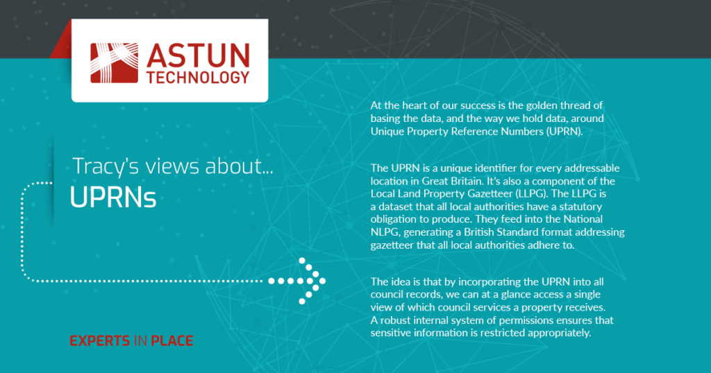
As a council, the majority of services we deliver are to a property or a person within that property. To be able to identify where our services are delivered and tie records together we need to be able to spatially map out or report on locational data. The UPRN holds specific coordinates to a specific addressable feature, and by holding the UPRN in any back-office system, data is exportable, reportable and mappable.
Our mission at Walsall Council is to ensure all existing and new back-office systems hold the UPRN and standardised addressing from a single source of the truth, our centralised address gazetteer.
Even though we send the Standard ITT to procurement, things have gone horribly wrong in the past. Suppliers have answered yes to integration, but forget to mention it can cost around £20k+ in additional costs to achieve this or plan on charging us for an external gazetteer!! It can be really costly if we don’t get the commitment to integrate during the tender process, if we don’t ask the right questions of the right people during the tender process or if the SMEs are not involved in that tender evaluation process, things can get missed.
We are going to tell you about the good, the bad and the ugly side of our experiences with suppliers and the resistance from within the council we have encountered to realise the benefits of the single golden thread that will tie all our records together, the UPRN.
You can register for GeoPlace for free here. Don’t forget to say hello to the Astun team who are proudly sponsoring the event.