It may seem odd to celebrate the 20th birthday of a piece of software, but it makes perfect sense when that software is QGIS.
Despite appearances, some of us at Astun are old enough to remember when QGIS burst onto the GIS scene. As an open source alternative to proprietary mapping software, it was originally the choice of more free-spirited geospatial professionals, such as our founder, Mike Saunt.
However, QGIS has since won the hearts of many medium and large UK organisations and not just because it’s free. In fact, for many of our clients, the financial benefits of using QGIS are the least of their concerns. Instead, they are attracted by the prospect of achieving more accurate, aesthetically pleasing maps in a shorter time frame. In this, they are not alone.
Improving the UK’s daily mapping
By 2016, QGIS was being used to produce 80% of the FT’s maps. This led Steve Bernard, then the Interactive Design Editor, to publicly comment that “QGIS has been instrumental in changing how we produce maps, and in conjunction with other tools such as Blender have helped me to be more creative with how we approach maps.”
That same year, The Economist began using QGIS. Some five years later, Marie Segger, Data Journalist, revealed that “Using QGIS improved our work significantly: our maps are more precise and take a fraction of the time to create, which means we can spend more time fine-tuning the details.”
QGIS around the world
Of course, QGIS isn’t just attractive to the UK’s publishing industry. With an estimated 100,000 users worldwide, the UK is believed to account for only 11% of the global user base. The United States accounts for another 40% with circa 5% of users based in Canada and France.
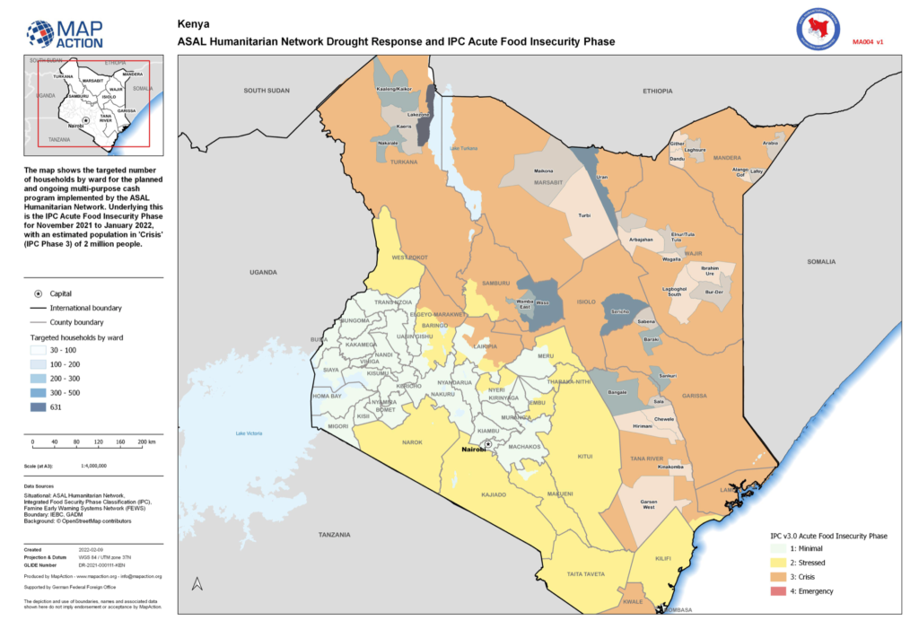
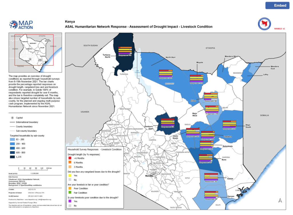
Whilst volunteering for MapAction, Ant Scott, our lead QGIS trainer, has taught QGIS in diverse locations, including Cameroon, Kazakhstan and the Democratic Republic of Congo. He’s even developed a familiarity with QGIS’s Russian interface. In Ant’s experience, the availability and accessibility of QGIS opens up huge possibilities for people working on disaster risk reduction and management.
QGIS at Astun
Closer to home, it’s fair to say that QGIS underpins many of Astun’s products and projects. Head of Platform, Nick Turner, comments: “Many clients use QGIS in conjunction with other open source software, such as PostGIS and GeoServer. These powerful combinations enable effective data sharing, collaborative data maintenance and improved access to data for spatial analysis. We help our clients save money and get up and running quickly by hosting these applications in the cloud and providing training and support to users.”
So, as we say happy 20th birthday to QGIS, and thank you to its founder Gary Sherman, we also want to acknowledge the incredible contribution made by QGIS’s developers. As Ant says “They are particularly good at adding features you didn’t know you needed, but then turn out to be essential.” If that doesn’t describe QGIS perfectly, we don’t know what does.
Next steps:
You can improve your QGIS skills with our popular online training courses or let our experts help you by providing open source support and bespoke development services. Please contact us for more information.