Local authorities have a duty to maintain an adequate and up-to-date supply of sites which are suitable for housing, employment and other types of development. A Call for Sites exercise provides a valuable early opportunity for interested parties to promote sites for consideration and helps to ensure that optimal development sites are considered and selected.
In recent months, we’ve had a flurry of enquiries from GIS and planning teams interested in holding paperless Call for Sites consultations. Frustrated by the inconsistencies across submissions and the additional effort required to scan in applications and redraw many complex polygons onto an internal GIS, these innovators have identified that a small investment now can save a lot of time and effort in the long run! During these consultations, we’ve identified several common pain points and developed a cost-effective interactive mapping solution that can be live in days.
In this blog, you’ll learn how to streamline the Call for Sites process to efficiently engage with interested parties. This makes it easier for them to offer suggestions, removes ambiguity in the extent and nature of the proposal and encourages engagement with communities to achieve preferred solutions.
Five indications that your Call for Sites process could be improved
- If it allows paper submissions
Paper submissions are bad news for planning teams who have to scan and store submissions electronically. Yet, in an Astun-conducted survey of ten councils, six still offer to accept submissions by post.
Switching to a purely online application process offers many benefits:
- Consistency: all proposals are accurately captured against the latest detailed Ordnance Survey mapping
- Immediate reference to existing constraints on development
- Save time: no scanning is required
- A paperless solution is better for the environment
- Users can receive immediate confirmation that their submission has been received
- If it doesn’t make critical information readily available
Previous Call for Sites submissions can be automatically reconsidered by a council. However, few councils share this information alongside a map showing previous submissions. In our survey, only four of the ten councils advised users not to resubmit unless information had changed.
Showing users the location of previous proposals and constraining factors and explaining that previously submitted valid proposals remain under consideration greatly reduces the risk of receiving duplicate submissions.
- If it doesn’t specify what base mapping to use
Call for Sites applications have to be accompanied by a map showing the boundaries of a proposed location. Councils which don’t specify a map are vulnerable to receiving submissions accompanied by out-of-date or hand-drawn maps, or, worse still, descriptions of the land.
Recommending a preferred map, such as Ordnance Survey MasterMap, helps combat this. Better still, you can provide users with an interactive map to use.
- If you spend time redrawing maps
Unless you use an interactive map that’s integrated with your GIS, someone has the unenviable job of manually plotting each user-supplied map (paper or electronic) in your GIS. Although this might not be too onerous if maps are electronic and well annotated, it can be a time-consuming and error-fraught process if maps are of poor quality or drawn by hand. Most contributors would need to pay to licence high-quality up-to-date maps, some are reluctant to do so.
Switching to an interactive map eliminates this frustrating admin task. Instead, proposers can capture a precise polygon extent against OS mapping which is automatically loaded into the system.
- If it keeps planners in the dark
Unless your Call to Site data is automatically added to your GIS, planners and GIS officers can’t access a real-time view of submissions. Sometimes there can be a significant delay between submission and consideration by officers.
Using an interactive map that links to your GIS ensures that decision-makers can immediately access submitted information. Accurate site area measurements can be calculated automatically making it possible to determine when potential quotas are reached.
Interactive maps make it possible for you to:
Why interactive maps are the answer
- Eliminate paper applications
- Make it simple for interested parties to make consistent, accurate submissions
- Accept online submissions that feed into your GIS
Introducing the Astun Call for Sites solution
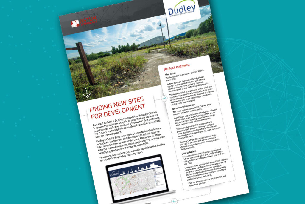
Dudley MBC is the first council to implement our new Astun Call for Sites interactive map and electronic submission process. Here are some of its key features:
- Base maps are controlled by the council
- Relevant layers, e.g. boundaries and green belt, are clearly displayed
- A look-up function helps users find the exact location required
- Key information can be automatically displayed on the map, including previous submission locations, green belt and boundaries
- An intuitive drawing tool enables users to precisely draw a polygon to define the proposed site
- Users can only draw polygons within the council boundaries
- Once submitted, relevant information (such as the polygon ID and area) automatically pre-populates a downloadable application form (Word) or online form
- Planning and GIS teams can view real-time submissions in their iShare* or desktop GIS
*The solution is also available as a standalone if you don’t already have iShare.
Want to find out more?
Add yourself to our Call for Sites mailing list. You’ll receive a copy of this blog, helpful hints on how to improve the user experience and a copy of our new Dudley Call for Sites case study.